
The Making of Bartholomew’s Enhanced 1945
Vintage Map of the Pentland Hills
Cumulative work of five generations of mapmakers
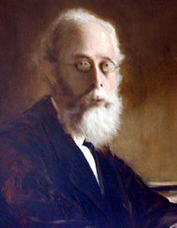
The Bartholomew family’s story is closely tied to the mapping of Scotland. One of its most innovative figures was John Bartholomew Junior (1831– 1893), an engraver and cartographer who helped change how maps communicate the shape of the land.
John pioneered the use of “layer colouring”: different colours indicated different heights. Greens, browns and whites helped readers recognise the rise and fall of the terrain at a glance. The technique was both practical and beautiful, and it became an important part of the Bartholomew mapmaking tradition. It has been adopted by mapmakers worldwide since.
A map made for walkers
In 1885, John engraved the original Pedestrian’s Map of the Pentland Hills, at a scale of one and a half inches to the mile. Unlike a general-purpose map, it was designed for people who wanted to explore the hills on foot. It included nine walking routes, detailed itineraries, and advice on reaching the starting points by train or bus from Edinburgh. It was a map and a guidebook in one — not simply showing the Pentlands but helping people get out and enjoy them.
Bringing the 1945 map to life
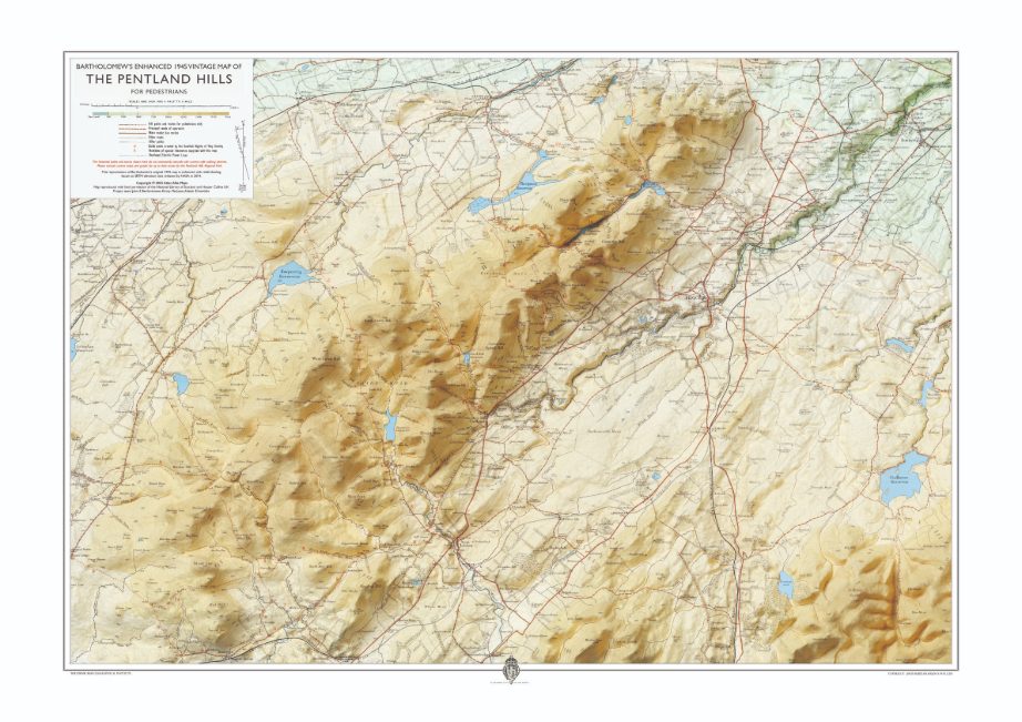
This map grows out of that long tradition. The 1945 Bartholomew map has its own distinctive lettering, colours and vintage character. The aim of this project was to preserve those qualities while making the underlying landscape easier to see.
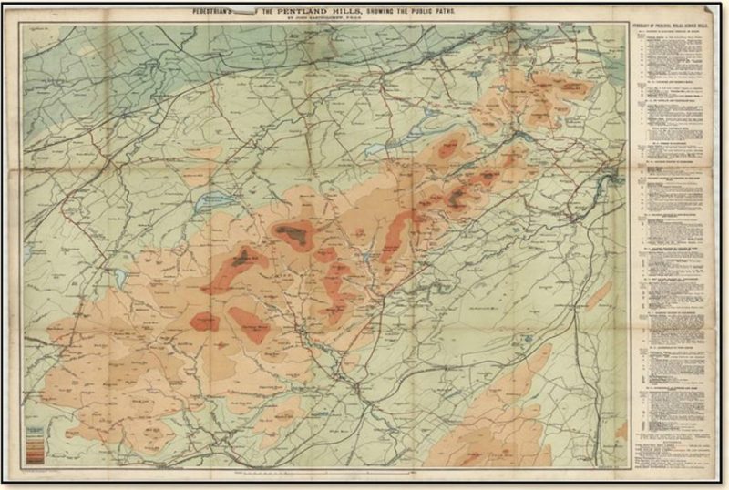
The Pentland Hills map went through numerous editions, right through to 1990, under the scrutiny of successive generations of the Bartholomew family. The revisions for each edition were built on top of the same underlying engraved base map of 1885.
From paper original to digital artwork
The starting point was a paper copy of the 1945 map from the National Library of Scotland. It was scanned, then carefully cleaned and digitally restored to provide a clear base for this new edition.
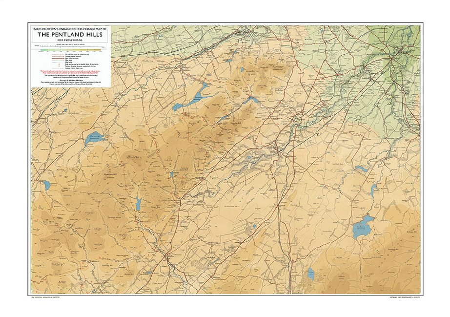
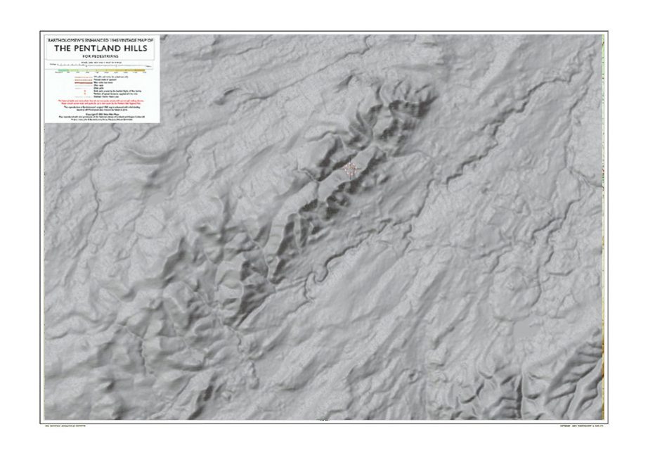
Next came modern elevation data from NASA’s Shuttle Radar Topography Mission. The Space Shuttle Endeavour collected measurements over Scotland in February 2000. These datasets were made publicly available from 2014 and used to build a digital model of the land’s surface.
Shading the hills
The elevation model was used to create digital hill shading. This simulates a sunlight effect falling across the landscape, bringing out ridges, slopes and valleys. Combined with the original map, it gives the hills a subtle three-dimensional quality. In reality, the vertical relief was exaggerated by a factor of x 15 here, to achieve this effect.
Achieving the right balance took experimentation. Too much shading would overwhelm the legibility of the historic map; too little would understate the contours of the land. Adjustments and test prints helped find a balance that reveals the shape of the Pentlands without competing with the original cartography.
Why make this new edition?
The purpose was not to replace the 1945 map, but to see it afresh. Its original cartography and vintage character remain at the heart of the design. The added relief offers another way to appreciate the landscape, bringing together generations of mapmaking skill and the possibilities of modern digital mapping. The adaptation also creates a distinct new edition and helps protect the original map’s copyright.
Project team: John E A Bartholomew, cartographic editor and publisher; Alistair Dinwiddie, cartographer, map production project manager; Kirsty Maclean, founder of Atlas Alba Maps, GIS specialist in digital map restoration.
Printed by GMP Print Solutions: Each print is produced locally using state-of the-art, high- quality inkjet technology just two miles east of the Pentland Hills. Printed at A1 size (841 × 594 mm) on 200 gsm satin uncoated paper or 320gsm fine art paper, hand cut and carefully inspected. GMP Print Solutions is a sustainable, carbon-balanced supplier.